
Photogrammetric preservation of evidence in the course of construction measures
DB Netz AG commissioned Mull und Partner Ingenieurgesellschaft mbH Hannover, Osnabrück branch, with the preliminary preservation of evidence for the establishment of a staging area for construction materials in the course of the route expansion. The preservation of evidence included chemical/physical soil investigation as well as the overall condition survey of the area. The photogrammetric survey was carried out with the use of aircraft technology (drone).
The approx. 65,000 m² area was systematically flown over and a total of 176 aerial photographs were taken. With the help of another 59 oblique images of the dam area, the level of detail was to be increased. The image resolution is approx. 1 pixel per cm. A coherent orthophoto was calculated from the individual photos and then a digital terrain model (DTM) was created via a photogrammetric evaluation.
Figure 1: Digital terrain model, ortho view, height scaling (total)
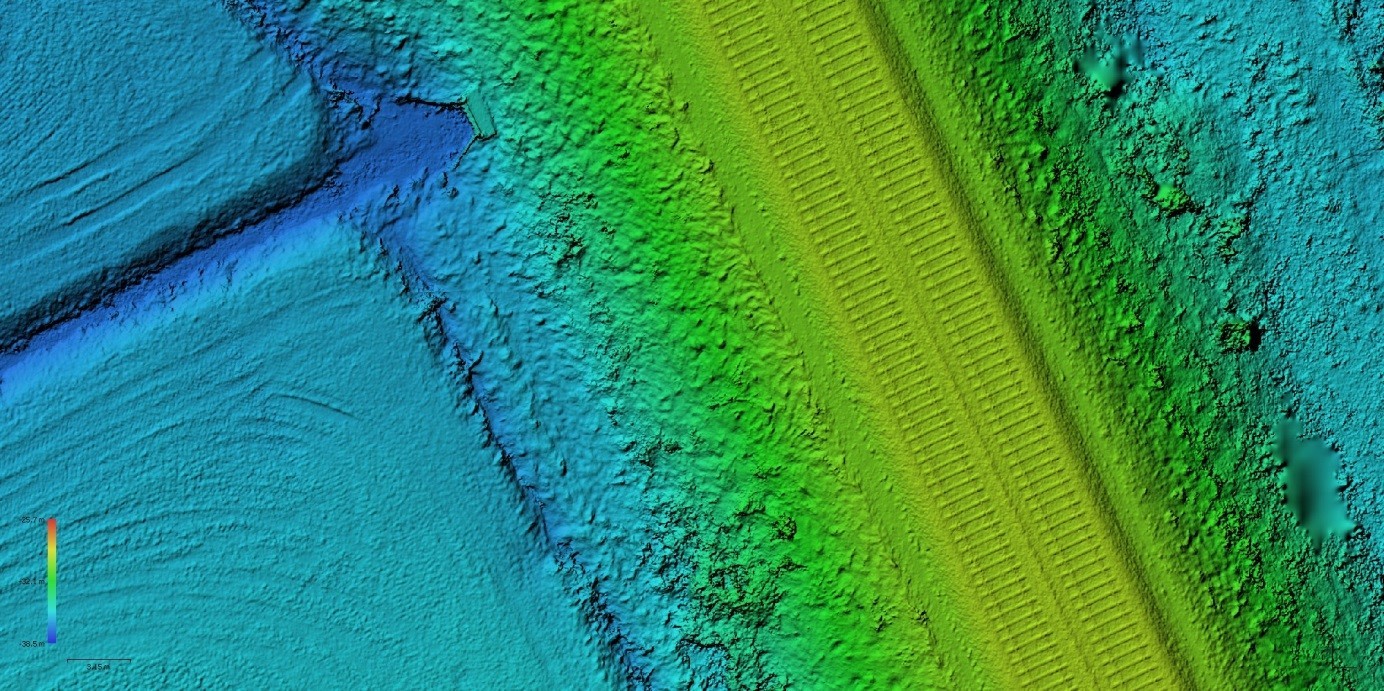
Figure 2: Digital terrain model, ortho view, height scaling (detail section)
Figure 3: Digital terrain model, oblique view of the embankment fill
With the aerial survey and the photogrammetric evaluation, an orienting terrain survey for the area under consideration is carried out at the same time as the visual determination of the condition. With this database, structural changes, for example due to construction activities or other events (landslides, subsidence, etc.), can be easily detected by repeated measurements. With the data generated, deviations can not only be visualised but also balanced. For example, cubature calculations and mass determinations (allowances) can be created and checked for plausibility. The use of modern flight technology in the form of drones, 3D visualisation and photogrammetric evaluation enables efficient and economical planning and monitoring of earthworks measures. By using these cost-effective methodologies, the initial state, intermediate construction states and changes during construction can be reliably documented and calculated.
Mull und Partner Ingenieurgesellschaft mbH has comprehensive know-how in the field of geodetic data processing in practical application. Starting with the digital aerial photo evaluation, the use of LIDAR data and the recording in GIS systems up to the creation of orthophotos (aerial photo plans) and the derivation of precise surface models, M&P also offers on-site recording with modern aircraft and recording systems. With many years of experience in the field of construction monitoring, we know what matters.
We provide the following services:
- Object measurements in position and height
- 2.5-D models of high accuracy and resolution with superimposed orthophoto or existing planning.
- Recording of changes / ground movements to the exact reporting date
- Calculation of cubatures (cut and fill)
- Comparison of target and actual building conditions in the digital terrain model
- Preservation of evidence (recording the condition of events such as erosion, landslides, subsidence, etc.)
- Measurement preparation as a basis for billing
- Plausibility check of billed masses or cubatures
- Integration into BIM processes.
We are also happy to develop individual concepts for sensor technology, data evaluation and presentation for you.
We are looking forward to your applications! Talk to us!