
A logistics company is planning the construction of a new logistics centre on an approx. 21 ha field and pasture area on the BAB 66 near Flieden. The scope of services includes a historical investigation to explain possible subsoil contamination by contaminated sites, orienting investigations to assess the waste legal situation and subsoil investigations to assess the suitability of the soil for construction. In addition to the subsoil investigations just described to assess the suitability of the soil as subsoil, extensive cut-and-fill measures are planned due to the steep slope of the area of approx. 18 m.
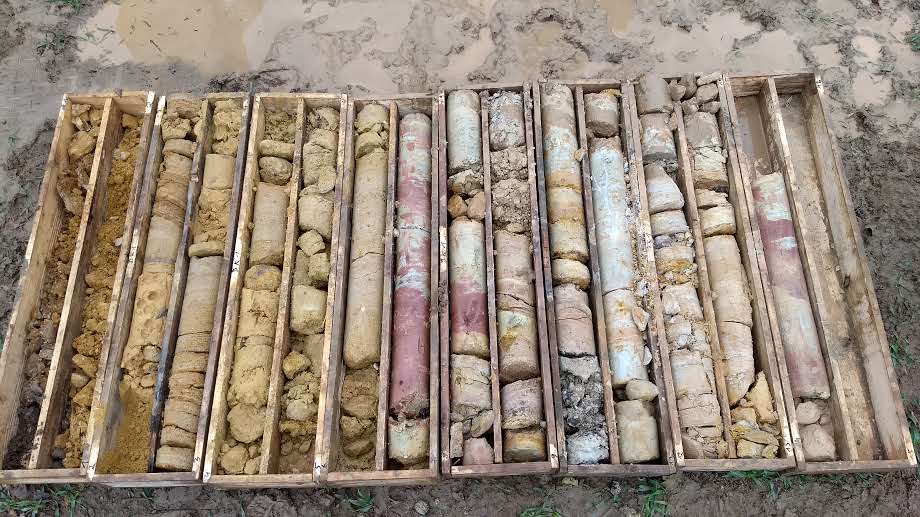
Over a period of two weeks, 36 boreholes were drilled to determine the soil structure and 30 pile-driven soundings were carried out to determine the bearing density. Based on the results of the boreholes for the soil structure, as well as the derivation of the characteristic soil parameters, a very complex cut-and-fill measure was planned with the help of AutoCAD Civil 3D.
The subsoil has a very heterogeneous structure. Underneath the topsoil, there are tertiary deposits. On the one hand, there are stiff to semi-solid clays and silt and, on the other hand, sand-silt mixtures to narrowly graded sands. Below the tertiary deposits are weathered to decomposed sandstones of the middle Buntsandstein.
The cut-and-fill measure was carried out for two different heights of a foundation base. The total cut and fill quantities as well as the cut and fill quantities for the individual soil horizons were calculated. In addition, recommendations for the reinstatement of the soil material and information on soil improvement measures have been provided.

The construction of a new logistics centre is planned on an area of approx. 21 ha of arable land and pasture. In addition to the classic subsoil investigations to assess the suitability of the soil as subsoil, extensive cut-and-fill measures are planned due to the steep slope of the area of approx. 18 m.
36 boreholes were drilled to determine the soil structure and 30 penetration tests were carried out to determine the bearing density. Based on the results of the boreholes for the soil structure, as well as the derivation of the characteristic soil parameters, a very complex cut-and-fill measure was planned with the help of AutoCAD Civil 3D.
The subsoil has a very heterogeneous structure.
The cut-and-fill measure was carried out for two different heights of a foundation base. The total cut and fill quantities as well as the cut and fill quantities for the individual soil horizons were calculated. In addition, recommendations for the reinstatement of the soil material and information on soil improvement measures have been provided.